

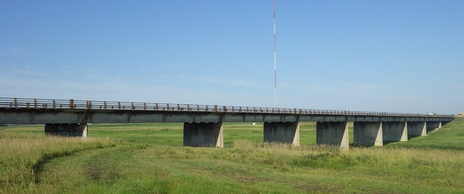
Commuters travelling to Winnipeg via Highway 200 may well be looking for another route in the next six months. This spring, a major reconstruction of the Red River Floodway bridge will begin.
By late summer, the bridge along Highway 200 will be closed to all traffic and is expected to remain unpassable for a full year. Completion is scheduled for autumn of 2026.
The bridge structure was built in 1965 at the time when the Red River Floodway was first created. Sixty years later, Manitoba Transportation and Infrastructure (MTI) reports that its condition has deteriorated to such an extent that a major rehabilitation is needed.
They anticipate the newly rebuilt bridge to last another 25 to 40 years once complete.
The upcoming project involves some upgrades in design which will significantly widen the roadway. At the same time, a new parking area will be created next to the bridge to provide access to the nearby Duff Roblin Parkway Trail.
The existing narrow passage across the bridge makes staged construction impossible to safely carry out. MTI says that detour routes will be announced as the construction date nears.
Floodway History
The Red River Floodway was an ambitious project that took five years to complete, from 1962 to 1968. It was created under the leadership of Manitoba’s Premier Duff Roblin and Prime Minister John Diefenbaker.
It took $62.7 million to complete, the cost of which was split 60/40 between the federal and provincial governments.
During its 150-year history, the city of Winnipeg experienced partial and severe floodwaters many times. It was the devastating flood of 1950 that finally inspired serious conversations around flood mitigation efforts.
At the height of the 1950 flood, nearly one-tenth of the city was underwater. More than 10,000 homes were inundated, some with heights of up to 15 feet of water. More than 100,000 residents were forced to evacuate.
The event went down in history as one of the greatest natural disasters in Canada. Over $22 million dollars was needed of the Manitoba Flood Relief Fund to aid flood victims, and another $126 million was spent to respond to flood damages.
The Red River Floodway, colloquially known as “Duff’s Ditch,” became the largest excavation project to be undertaken in Canada at that time. On a global scale, it was recognized as one of the most significant manmade channels to be found anywhere.
While the creation of the Red River Floodway ensured lower-risk flood events for the province’s city dwellers, it put certain communities near the Red River south of Winnipeg at greater risk of flooding.
For this reason, ring dikes were constructed around seven communities south of Winnipeg, including St. Adolphe and Morris, between 1966 and 1972. A similar federal and provincial split occurred to cover this $9.3 million cost.