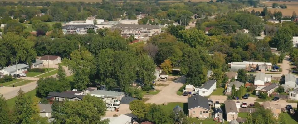
In this summer series, The Citizen is taking a look at the unique history of each town in our corner of southeastern Manitoba. Let’s take some time to learn more about this beautiful part of the province we call home.
The modern history of Île-des-Chênes, as with most of southeastern Manitoba’s francophone towns, goes back to the late 1800s. That’s when the government originally purchased land from the Hudson’s Bay Company and in turn sold it to newcomers.1
The first system used to demarcate and describe land parcels in this area was put forth by Lord Selkirk and based on the long-lot system used in Québec. Narrow 3.2-kilometre lots that fronted the Red River became the standard division of land for the Red River Colony. These lots were then grouped into parishes with a centrally located church.2
New settlers to this area were mostly from Québec and New England, and they preferred a modified version of the parish lot system.
The Roman Catholic Diocese of St. Boniface was determined to keep as many French-speaking people here as possible. To cater to francophone settlers, they created a series of outer or “satellite” river lot parishes along the Seine and Rat Rivers. These satellite river lot groupings eventually became the communities of Ste. Anne des Chênes, Lorette, the Rat River Settlement, St. Malo, Grande Pointe, and Île-des-Chênes.2
The Île-des-Chênes settlement was unusual in that the section of river channel along which each lot was situated was only five kilometres long. As well, it only appeared on a few maps at that time (as Oak River) and only had actual flowing water at certain times of the year, or during especially wet years. Every spring, the area would flood and its residents would have to shelter on the highest point on their land.
Because this area was covered in oak trees and often surrounded by melting snow, its name became Oak Island, or Île-des-Chênes.1 2
The settlement at Grande Pointe was also noteworthy, but for a very different reason. When the Grande Pointe settlement was being demarcated, a major error in mapping caused its lots to overlap for two miles into the St. Norbert parish. This created an administrative nightmare and resulted in many unusually shaped lots.2
New settlers to Île-des-Chênes did what most new residents in southeastern Manitoba did: they turned their land into a farming and agricultural community. A post office was established for the region in 1890 and the local Catholic parish began operating in 1905. Telephone service came to town in 1920, but Île-des-Chênes only got electricity in 1946.3
In 1904, the area surrounding Île-des-Chênes was organized into the Coquart School Division. The town had a one-room schoolhouse called the École Coquart.
In November 1958, the provincial government passed an amendment to The Public Schools Act, allowing them to establish new school divisions for secondary education in Manitoba.
By 1965, this amendment caught up to the Coquart School Division. Coquart was dissolved and the area became part of the Seine River School Division, where it remains today.4 5
A modern-day claim to fame for this area is the Wildlife Haven Rehabilitation Centre. According to their website the WHRC has been rehabilitating injured, sick, and orphaned wildlife since 1984.6
The 2021 census indicates that Île-des-Chênes is currently home to 1,606 residents, up slightly from 1546 in 2016.7
Although this was once a primarily francophone community, French is now the mother tongue of only 22.9 percent of the population, and only 37.3 percent of the population know French.3
REFERENCES
1 “Île-des-Chênes,” Bonjour Manitoba. Date of access: July 21, 2024 (https://bonjourmanitoba.com/en/regions/ile-des-chenes).
2 “Native Land Use,” Government of Manitoba. Date of access: July 21, 2024 (https://www.gov.mb.ca/chc/hrb/internal_reports/pdfs/crow_wing_aborigina…).
3 “Île-des-Chênes,” Wikipedia. Date of access: July 21, 2024 (https://en.wikipedia.org/wiki/%C3%8Ele-des-Ch%C3%AAnes).
4 “Historic Sites of Manitoba: Coquart School No. 1300,” Manitoba Historical Society. Date of access: July 21, 2024 (http://www.mhs.mb.ca/docs/sites/coquartschool.shtml).
5 “Events in Manitoba History: School Divisions,” Manitoba Historical Society. Date of access: July 21, 2024 (http://www.mhs.mb.ca/docs/events/schooldivisions1959.shtml).
6 “About Us,” Wildlife Haven. Date of access: July 21, 2024 (https://wildlifehaven.ca/pages/aboutus).
7 “Profile Table: Île-des-Chênes…” Statistics Canada. Date of access: July 21, 2024 (https://www12.statcan.gc.ca/census-recensement/2021/dp-pd/prof/details/…).


